
Overview#
Here we give a high-level overview of geovista.
We briefly discuss its goals and motivation, and introduce you to the rich, powerful ecosystem that underpins its evolving capability.
Motivation#
geovista is a pure Python package that offers performant,
publication quality 3D cartographic rendering of Earth Science data.
Its goal is to lower the bar for scientists, such that they can easily analyze, visualize, and explore their rectilinear, curvilinear and unstructured geospatial data interactively in 3D, whilst also supporting traditional 2D static plots, cartographic projections and coordinate transformations.
Our intention is for geovista to be a cartographic gateway into the
powerful world of PyVista, and all that it offers. Opening the door
for scientists to rediscover their data through a responsive visualization
toolchain that leverages the power of the GPU.
Simply put,
“GeoVista is to PyVista”, as “Cartopy is to Matplotlib”
That’s our aspiration.
Akin to Cartopy, we intend geovista to remain as flexible and
open-ended as possible to the Scientific Python community. This means that
geovista will remain agnostic to packages that specialize in preparing
your spatial data for visualization, such as geopandas, iris and
xarray.
Ecosystem#
geovista is built on the shoulders of giants, namely PyVista and the
Visualization Toolkit (VTK), thus allowing it to easily leverage the power
of the GPU.
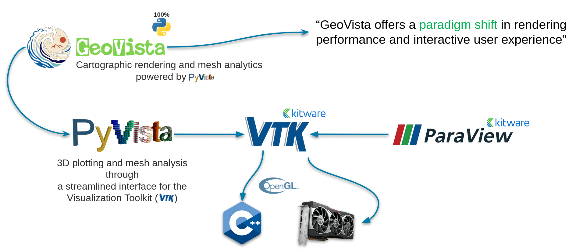
Fig. 1: Ecosystem of geovista#
As shown above, geovista is built upon a performant, established, and
feature rich VTK toolchain, which is supported and maintained by
Kitware and the open-source community.
This toolchain is enabled through PyVista, which exposes the powerful visualization backend of VTK through an intuitive Pythonic interface.
PyVista in a Nutshell#
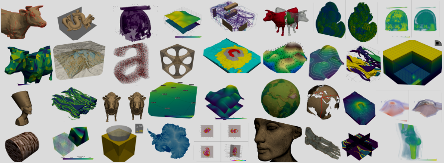
Fig. 2: PyVista Examples#
PyVista is a powerful open-source 3D visualization library built on VTK, providing:
A Pythonic, high-level, and streamlined API to VTK
Batteries-included access to a rich suite of mesh filtering algorithms
GPU accelerated visualization
Scales up to large and complex geometries
Static and interactive plot integration within Jupyter ecosystem
Development Status#
It’s still early days for geovista, but we’re already excited about the
potential and promise that it might offer to the Earth Science community.
Our primary focus at the moment is to provide a stable API and core set of features … we’re working hard on that, but we’re not there yet!
Thanks for your patience 🙏