
注釈
サンプルコードを全てダウンロードするには 末尾に移動
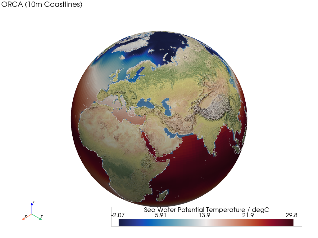
ORCA2 Grid#
この例では、曲線グリッドをレンダリングする方法を示します。
📋 まとめ#
Creates a mesh from 2D latitude and longitude curvilinear cell bounds.
出来上がったメッシュには四角形セルが含まれます。
It uses an ORCA2 global ocean with tri-polar model grid with sea water potential temperature data. The data targets the mesh faces/cells.
Note that a threshold is also applied to remove land NaN cells, and a
Natural Earth base layer is rendered along with Natural Earth coastlines.
from __future__ import annotations

import geovista as gv
from geovista.pantry.data import nemo_orca2


def main() -> None:
    """Plot an ORCA2 curvilinear grid.

    Notes
    -----
    .. versionadded:: 0.1.0

    """
    # Load the sample data.
    sample = nemo_orca2()

    # Create the mesh from the sample data.
    mesh = gv.Transform.from_2d(
        sample.lons,
        sample.lats,
        data=sample.data,
        name=f"{sample.name} / {sample.units}",
    )

    # Remove cells from the mesh with NaN values.
    mesh = mesh.threshold()

    # Plot the curvilinear grid.
    p = gv.GeoPlotter()
    p.add_mesh(mesh)
    p.add_base_layer(texture=gv.natural_earth_1())
    p.add_coastlines()
    p.add_text(
        "ORCA (10m Coastlines)",
        position="upper_left",
        font_size=10,
    )

    # Define a specific camera position.
    p.camera.zoom(1.3)

    p.add_axes()
    p.show()


if __name__ == "__main__":
    main()