
注釈
サンプルコードを全てダウンロードするには 末尾に移動 。
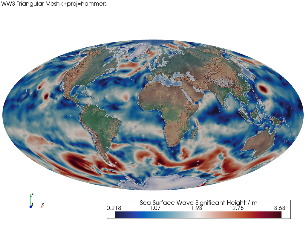
WW3 Triangular Mesh (Projected)#
This example demonstrates how to render a projected unstructured triangular mesh.
📋 まとめ#
Creates a mesh from 1D latitude and longitude unstructured points and connectivity. o The resulting mesh contains triangular cells. The connectivity is required to construct the cells by indexing into the unstructured points.
WAVEWATCH III (WW3) の海面波の有義波高データは、メッシュの節点/点に配置され、メッシュ面/セルに渡って補間されます。
A Natural Earth base layer is rendered along with Natural Earth coastlines, and the mesh is also transformed to the Hammer & Eckert-Greifendorff azimuthal projection.
from __future__ import annotations

import geovista as gv
from geovista.pantry.data import ww3_global_tri


def main() -> None:
    """Plot a projected WW3 unstructured triangular mesh.

    Notes
    -----
    .. versionadded:: 0.1.0

    """
    # Load the sample data.
    sample = ww3_global_tri()

    # Create the mesh from the sample data.
    mesh = gv.Transform.from_unstructured(
        sample.lons,
        sample.lats,
        connectivity=sample.connectivity,
        data=sample.data,
        name=f"{sample.name} / {sample.units}",
    )

    # Plot the unstructured mesh.
    crs = "+proj=hammer"
    p = gv.GeoPlotter(crs=crs)
    p.add_mesh(mesh)
    p.add_base_layer(texture=gv.natural_earth_hypsometric())
    p.add_coastlines()
    p.add_text(
        f"WW3 Triangular Mesh ({crs})",
        position="upper_left",
        font_size=10,
    )

    # Define a specific camera position.
    p.view_xy()
    p.camera.zoom(1.5)

    p.add_axes()
    p.show()


if __name__ == "__main__":
    main()