
注釈
サンプルコードを全てダウンロードするには 末尾に移動 。
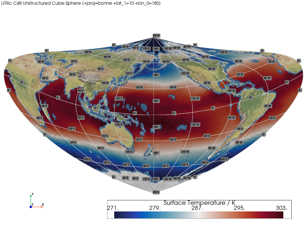
LFRic Mesh (Projected)#
This example demonstrates how to render a projected unstructured quadrilateral mesh.
📋 まとめ#
Creates a mesh from 1D latitude and longitude unstructured points and connectivity.
The resulting mesh contains quad cells. The connectivity is required to construct the cells by indexing into the CF UGRID unstructured points.
It uses an unstructured Met Office LFRic C48 cubed-sphere of surface temperature data located on the mesh faces/cells.
Note that a threshold is also applied to remove land NaN cells. A Natural Earth
base layer is also rendered along with Natural Earth coastlines and a graticule.
The mesh is also transformed to the Bonne projection.
from __future__ import annotations

import geovista as gv
from geovista.pantry.data import lfric_sst


def main() -> None:
    """Plot a projected LFRic unstructured mesh.

    Notes
    -----
    .. versionadded:: 0.1.0

    """
    # Load the sample data.
    sample = lfric_sst()

    # Create the mesh from the sample data.
    mesh = gv.Transform.from_unstructured(
        sample.lons,
        sample.lats,
        connectivity=sample.connectivity,
        data=sample.data,
        name=f"{sample.name} / {sample.units}",
    )

    # Remove cells from the mesh with NaN values.
    mesh = mesh.threshold()

    # Plot the unstructured mesh.
    crs = "+proj=bonne +lat_1=10 +lon_0=180"
    p = gv.GeoPlotter(crs=crs)
    p.add_mesh(mesh)
    p.add_base_layer(texture=gv.natural_earth_1())
    p.add_coastlines()
    p.add_graticule()
    p.add_text(
        f"LFRic C48 Unstructured Cube-Sphere ({crs})",
        position="upper_left",
        font_size=10,
    )

    # Define a specific camera position.
    p.view_xy()
    p.camera.zoom(1.5)

    p.add_axes()
    p.show()


if __name__ == "__main__":
    main()